Home/Mountains/Knuckles Five Peaks (Dumbara Range)

Back
MountainsCentral ProvinceFeatured Destination

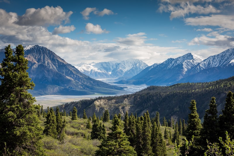
Knuckles Five Peaks (Dumbara Range)

Matale / Kandy Districts, Sri Lanka
4.9/ 5.0
195 traveler reviews
Knuckles Five Peaks (Dumbara Range) - Photo 1
Mountains
1 / 3

Destination Overview

Essential background & heritage of Knuckles Five Peaks (Dumbara Range)

UNESCO World Heritage mountain fold with five knuckle-like peaks, cloud forests, and highland streams.

Known historically as Dumbara Kanduvetiya (Mist-laden mountains) and named Knuckles by British cartographers for its resemblance to a clenched fist, this 18,500-hectare mountain wilderness rises to 1,900 meters. It harbors miniature cloud forests, pygmy trees, rare pygmy lizards found nowhere else on earth, and isolated traditional villages like Meemure.
Scenic ViewpointPhotography PermittedLocal Guide Recommended

Things To Do & Experiences

Curated activities recommended by local explorers

πŸŒ„

Sunrise Mountain Summit Hike

Embark on an early morning trek above clouds and rolling mountain ranges.

πŸƒ

Highland Ceylon Tea Estate Walk

Stroll among misty green tea plantations and meet local Ceylon tea growers.

πŸ“Έ

Panoramic Gap & Viaduct Photography

Spot scenic railway passes, pine forests, and cascading waterfalls in the valleys.

β˜•

Relax at Hill Country Cafes

Enjoy fresh mountain brews, warm rotis, and cool fresh air in the hill towns.

Seasonality & Weather Guide

Real-time climate profile, temperature ranges & month-by-month travel matrix

Oct: Monsoon Rain & Mist
Climate Zone
Cool Montane / Hill Country
Avg Temperature
14Β°C – 22Β°C
Humidity & Air
60% – 70% (Crisp & Fresh)
Prime Window
June to August & December to February
Month-by-Month Travel Conditions:
Janβ˜€οΈPeak
Febβ˜€οΈPeak
Marβ˜€οΈPeak
Aprβ˜€οΈPeak
May🌀️Good
Jun🌧️Wet
Julβ˜€οΈPeak
Augβ˜€οΈPeak
Sep🌀️Good
Oct🌧️Wet
Nov🌧️Wet
Decβ˜€οΈPeak
Peak Season: Clear skies, calm seas & dry hiking
Good / Shoulder: Mild weather & fewer crowds
Monsoon / Wet: Lush foliage, misty falls & low rates
Optimal Daily Hours6:00 AM – 9:30 AM

Best lighting for photography and cooler walking temperature.

Local Weather AdviceCrisp mountain air, rolling morning mist, and golden afternoon sun among tea hills.

Recommended stay duration: 3 – 5 Hours.

Visitor Tips & Advisory

Hiring an official wildlife department guide is mandatory. Pack waterproof gear as weather can turn swiftly.

πŸ’‘ Carry drinking waterπŸ‘Ÿ Wear sturdy footwearπŸ‘’ Bring sun protection

Interactive Location Map

Matale / Kandy Districts Β· Central Province

Get Driving Directions
Loading localized map...
GPS Coordinates:7.4500Β° N, 80.8000Β° E
Verified Pin

Write a Review

Share your authentic travel experience to help others plan their journey across Sri Lanka.

Anti-spam check:4 + 2 = ?

Traveler Reviews (0)

No reviews yet. Be the first adventurer to share your experience!
Nearby in Central Province

Nearby Attractions

Combine your visit with other remarkable destinations nearby
Explore all in Central Province
More Mountains

Similar Destinations

More top-rated mountains across Sri Lanka
View all Mountains
Admission
USD 15 (Foreign Adults)4.9